This article identifies the location of Daly Fall on the territory of Rawdon. It describes some of its features and presents certain facts about the Daly family, who might have given its names to this waterfall. A photograph shows the beauty of this fall, which is difficult to access as it is surrounded by private properties.
Much less know, this fall, located upstream from Mason Falls on the Rouge River, is named “Daly Fall.”
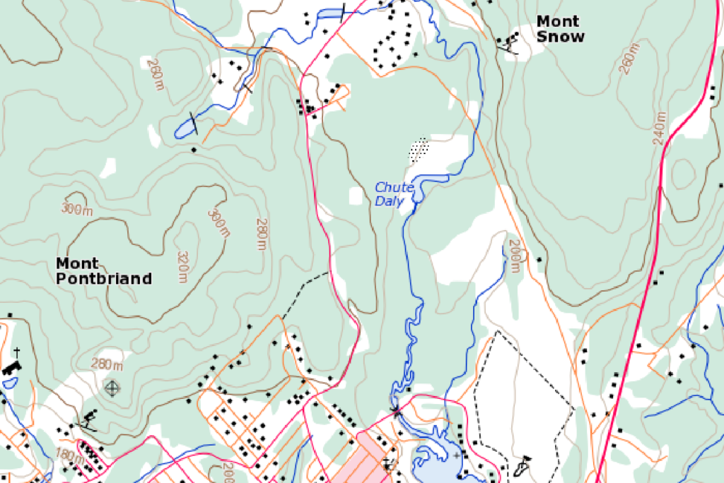
It is identified on certain maps, including the topographic map produced by the Government of Canada.

The origin and meaning of the name Daly Fall have so far not been determined by the Toponymy Commission of Quebec. However, Marcel Fournier, in his book entitled Rawdon : 175 ans d'histoire indicates that Daly Fall owes its name to James Daly, who owned the neighbouring lands. Research aimed at confirming that James Daly was in fact the owner of the neighbouring lands has so far not been conclusive. Still, it may be assumed that this name was retained in relation to the Daly family and because of the contribution of this family to the development of Rawdon.
The Daly family likely gave its name to this waterfall
To illustrate this contribution, the writings of Daniel Parkinson in his book Up to Rawdon were first consulted. There, we learn that John Daly, the first member of the Daly family to settle in Rawdon, lived in the parish of Notre-Dame in Montréal when he married Isabella Devlin on September 29, 1823. He probably moved to Rawdon soon after as, on October 20, 1823, lands agent Guy Colclough issued a location ticket to John Daly for the north half of lot 24 on range 3 of the township of Rawdon. Documents concerning the lands of Lower Canada indicate that lot 24 on range 3 was granted by decree to Christie Breadin in July 1820, but he apparently did not follow through on this ordinance. In December 1824, a statistical survey drawn by the surveyor Bouchette revealed that John Daly lived on lot 24 south on range 3 and Hugh Daly, on lot 24 north. However, only John was included in the 1825 census. The list of concessions on the site of the Registry of the Surveyor General of Quebec confirms that the letters patent of lot 24 south on range 3 were issued to John Daly on February 27, 1835 (see below).

Other members of the Daly family, including John’s brothers, also settled in Rawdon. James ended up on lot 23 south on range 5.

The eldest of the family, Luke, who was both a farmer and a merchant, was granted letters patent for lot 17 north on range 6 in March 1845. The announcement of his death in January 1861, published in the Montreal Herald and Daily Commercial Gazette, stated that he was the first to open a business in the village of Rawdon. He also went on to be postmaster from 1853 to 1861. First a farmer, Alexander went on to be a lands agent and to exercise great influence on the opening of the township of Chertsey.
Subdivided into one-acre parcels, lot 17 on range 5 became the centre of the village of Rawdon. Hugh, James and Luke Daly owned many of these parcels, as evidenced by the list of concessions drawn from the Registry of the Surveyor General of Quebec.
The Daly family and the creation of a Catholic parish
Among the first families to settle on the territory of Rawdon, the Daly family was closely tied to the creation of a Catholic parish in Rawdon. A history of Rawdon published in the newspaper L’Action populaire on April 17, 1924, recounts that Catholic life in Rawdon began with a mass celebrated in John Daly’s house. While certain sources indicate that this first mass took place in 1817, the article in L’Action populaire does not specify the year. It would however take several years for the first Catholic chapel to be built on account of differences of opinion, particularly regarding its location. A report, produced on August 9, 1831, by Father Caron of Saint-Esprit and countersigned by Thomas Lane and James Daly, recommended the construction on lot 17 of range 5, the site that was finally chosen. The first mass in this chapel was celebrated on September 21, 1834. Subsequently, in 1837, Luke Daly was elected among the first churchwardens of the parish, who were tasked with completing the financing of this chapel, among other things. Over the years, many members of the Daly family would join the ranks of religious communities, including the Sisters of Saint Anne.
Additional research, particularly on the property titles, must be done to establish the link between the Daly family and the waterfall of the same name.
Location and mapping – Daly Fall
The GeoGratis site of the Government of Canada determines the geographic coordinates of many locations in Canada in decimal format to seven significant figures. The Toponymy Commission of Quebec indicates only five significant figures but also provides the coordinates in sexagesimal format (degrees, minutes and seconds). Rawdon’s six falls are listed. The following table presents the coordinates of Daly Fall in decimal format from the Government of Canada site and in sexagesimal format from the Toponymy Commission’s site:
Coordinates | Decimal | Sexagesimal |
Latitude | 46.0716667 | 46⁰04’18’’ |
Longitude | 73.7094444 | 73⁰42’34’’ |
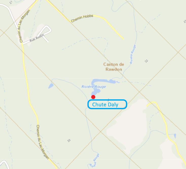
The interactive map on the site of the Registry of the Surveyor General of Quebec links the recent cartographic information to the original cadastre of the township of Rawdon. Reproduced below and annotated, this excerpt of the interactive map shows the location of Daly Fall.

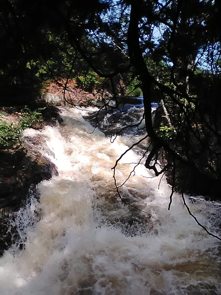
Photograph
Less spectacular than Rawdon’s other falls, given its smaller difference in elevation and weaker flow, and especially less accessible, as it is almost entirely surrounded by private properties, Daly Fall still deserves our attention, as evidenced by this photograph.

Sources
- Censuses of Lower Canada, the Canadas and Canada (1825, 1851 and 1861)
- Register of baptisms, marriages and deaths – Saint Patrick’s Parish in Rawdon
- Compilation of the list of concessions – Registry of the Surveyor General of Quebec – Document CA20R005_8_2
- Rawdon : 175 ans d’histoire / Marcel Fournier, Joliette, 1974
- Up to Rawdon: Settlers at Rawdon Township, Lower Canada, C. 1820-1852: Their Origins and Continued Migration Across Canada and the United States, Volume 1 & 2 / Daniel Parkinson, 2013, 1156 pages
- “Historique de Rawdon” [History of Rawdon], L’Action populaire, April 17, 1924, page 2 – available at BAnQ https://numerique.banq.qc.ca/patrimoine/details/52327/2577399 – It is likely that the information published in the newspaper was drawn from the booklet entitled Noces d’argent pastorales du Révérend J. M. Landry, 1899-1924, quoted by Marcel Fournier.
